Search results
5 hours ago · Storm Imagery. Locations and distances given here are approximate. Description and location information are supplied by the National Hurricane Center. Please note: satellite images are NOT a weather forecast. These images depict the near-real-time state of the atmosphere and are one input used to predict weather. For actual forecast information ...
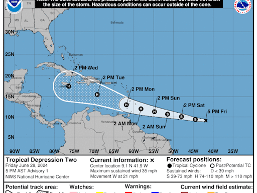
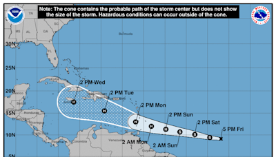
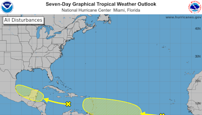
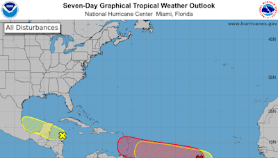
2 hours ago · A tropical depression that formed in the Atlantic east of the Windward Islands could become Hurricane Beryl by Sunday as it moves westward, the National Hurricane Center said in an advisory at 5 p.m. Friday. The season's second tropical depression is expected to become Tropical Storm Beryl overnight Friday or early Saturday, the second named ...
3 hours ago · The storm, called Tropical Depression Two, is traveling east of the Caribbean’s Windward Islands with maximum sustained wind speeds of 35 mph, according to the National Hurricane Center.
3 hours ago · According to the NHC's 5 p.m. forecast, the center of Tropical Depression Two was located 1225 miles east-southeast of Barbados and moving west at 17 mph.
5 hours ago · Our sources include the National Weather Service, NOAA National Hurricane Center, North Carolina State Climate Office, U.S. Department of Commerce, and North Carolina State University.
2 hours ago · Tropical depression could be Hurricane Beryl by Sunday thanks to favorable conditions in the tropical Atlantic Ocean, National Hurricane Center says NOAA/NESDIS/STAR GOES-East More Videos
- 4 sec
3 hours ago · Forecasters say there’s an 85% chance of more storms than usual. The hurricane season spans from June 1 through November 30, with most activity occurring between mid-August and mid-October. An average season has 14 named storms, seven hurricanes and three major hurricanes. For the first time, forecasters will use AI (artificial intelligence ...
People also ask
How many hurricanes will there be before November 30?
Will there be a hurricane east of the Caribbean in June?
When will hurricane watches be issued in the Windward Islands?
Will a hurricane hit the Windwards in June?
How many hurricanes are forecasted a year?
When is hurricane season?


