Search results
1 day ago · NOAA predicts above-normal 2024 Atlantic hurricane season. NHC New Products and Services for the 2024 Hurricane Season. Central Pacific. Eastern Pacific.
3 days ago · NOAA predicts above-normal 2024 Atlantic hurricane season. NHC New Products and Services for the 2024 Hurricane Season.
1 day ago · National Hurricane Center. Top News of the Day... view past news. Last update Mon, 1 Jul 2024 15:14:53 UTC. NHC issuing advisories for the Atlantic on Hurricane Beryl. Last advisory issued on Chris. Marine warnings are in effect for the Gulf of Mexico and Caribbean/SW Atlantic.
Tropical Weather Outlook. NWS National Hurricane Center Miami FL. 800 AM EDT Mon Jul 1 2024. For the North Atlantic...Caribbean Sea and the Gulf of Mexico: Active Systems: The National Hurricane Center is issuing advisories on Hurricane. Beryl, nearing the Windward Islands and Tropical Depression. Chris, located inland over eastern Mexico.
Data from the NOAA and Air Force Hurricane Hunters indicate that maximum sustained winds have increased to near 130 mph (215 km/h) with higher gusts. Beryl is a category 4 hurricane on the Saffir-Simpson Hurricane Wind Scale.
The letter inside the dot indicates the NHC's forecast intensity for that time: D: Tropical Depression – wind speed less than 39 MPH. S: Tropical Storm – wind speed between 39 MPH and 73 MPH. H: Hurricane – wind speed between 74 MPH and 110 MPH. M: Major Hurricane – wind speed greater than 110 MPH. NHC tropical cyclone forecast tracks ...
2 days ago · Hurricane Beryl Update Statement. THE SOUTHERN WINDWARD ISLANDS... storm surge to the Grenadine Islands, Carriacou Island, and Grenada. This is an extremely dangerous and life-threatening situation. the passage of these life-threatening conditions. wind speed of 92 mph (148 km/h) and a gust of 121 mph (194 km/h).
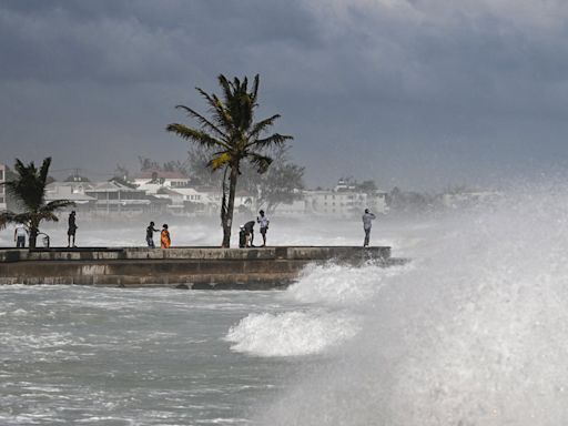
1 day ago · The eye of Hurricane Beryl "made landfall on Carriacou Island" at 11:10 a.m. ET, bringing 150 mph winds and a dangerous storm surge to islands on the eastern edge of the Caribbean, the National ...
If you are looking for high resolution, photographic quality satellite imagery of hurricanes and other storms please visit NESDIS . General Satellite Status Messages, including Outages. GOES Floater and Tropical Sector Imagery – 15 minute updates. NESDIS East Pacific Satellite Products.
2 days ago · NOAA predicts above-normal 2024 Atlantic hurricane season. NHC New Products and Services for the 2024 Hurricane Season.


